


Moselle Voting District, Jones County, Mississippi
About
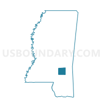
Outline

Summary
| Unique Area Identifier | 605868 |
| Name | Moselle Voting District |
| County | Jones County |
| State | Mississippi |
| Area (square miles) | 31.36 |
| Land Area (square miles) | 31.26 |
| Water Area (square miles) | 0.10 |
| % of Land Area | 99.69 |
| % of Water Area | 0.31 |
| Latitude of the Internal Point | 31.49208590 |
| Longtitude of the Internal Point | -89.26727210 |
Maps


Graphs
Select a template below for downloading or customizing gragh for Moselle Voting District, Jones County, Mississippi


Neighbors
Neighoring Voting District (by Name) Neighboring Voting District on the Map
- Barrontown-Macedonia Voting District, Forrest County, MS
- County Barn Voting District, Jones County, MS
- Ellisville Court House Voting District, Jones County, MS
- Glendale Voting District, Forrest County, MS
- Leeville Voting District, Forrest County, MS
- Pinegrove Voting District, Jones County, MS
- Rainey Voting District, Jones County, MS
- Shelton Voting District, Jones County, MS
- South Jones Voting District, Jones County, MS
- Union Voting District, Jones County, MS
Top 10 Neighboring County Subdivision (by Population) Neighboring County Subdivision on the Map
- District 3, Forrest County, MS (17,789)
- District 4, Jones County, MS (15,997)
- District 2, Forrest County, MS (12,655)
Top 10 Neighboring Place (by Population) Neighboring Place on the Map
Top 10 Neighboring Unified School District (by Population) Neighboring Unified School District on the Map
- Jones County School District, MS (49,698)
- Petal School District, MS (19,483)
- Forrest County Schools, MS (19,408)
Top 10 Neighboring State Legislative District Lower Chamber (by Population) Neighboring State Legislative District Lower Chamber on the Map
- State House District 104, MS (28,940)
- State House District 88, MS (25,071)
- State House District 89, MS (24,228)
Top 10 Neighboring State Legislative District Upper Chamber (by Population) Neighboring State Legislative District Upper Chamber on the Map
Top 10 Neighboring 111th Congressional District (by Population) Neighboring 111th Congressional District on the Map
Top 10 Neighboring Census Tract (by Population) Neighboring Census Tract on the Map
- Census Tract 9509, Jones County, MS (7,677)
- Census Tract 9511, Jones County, MS (6,248)
- Census Tract 102, Forrest County, MS (6,179)
- Census Tract 101.02, Forrest County, MS (6,153)
- Census Tract 9510, Jones County, MS (3,778)